
Scared of getting trapped inside Shinjuku Station?
That fear is entirely valid for any first-time visitor facing the Tokyo rail network. You do not need to download five niche transit applications to survive.
You really only need two tools working together. Pair Google Maps for door-to-door walking routes with Japan Travel by NAVITIME for exact platform numbers.
If you are strictly driving around rural Hokkaido, close this and read our rental car guide instead.
- Best for walking and street exits: Google Maps
- Best for exact platforms and pass filters: Japan Travel by NAVITIME
- Best offline backup route planner: Japan Travel by NAVITIME premium
- Time needed
- 10 minutes to set up
- Typical cost
- Free to roughly ¥500 monthly
- Base
- Works nationwide
- Booking
- Free on app stores
Top picks
Where we would book this
Klook
One account for passes, tickets and transfers
- Best for
- JR Pass and regional rail passes, theme-park tickets, airport…
- Checked
- September 2026
Official site. Same price for you.
Where we would book this
Japan Rail Pass official site
The only source of the current pass price and rules
- Best for
- Official conditions, eligibility and the current price of the…
- Checked
- September 2026
Official site. Same price for you.
Some links are affiliate links (marked “Partner link”). Prices are ranges checked in 2026; confirm on the official site before you book.
Navigating the Labyrinth: What Actually Matters

Japanese train stations are not just simple transit stops; they are sprawling underground cities. Shinjuku Station sees millions of passengers daily across thirty different platforms.
Navigating this requires more than just knowing the line name. You need the exact track number to avoid walking in endless circles underground.
That is the whole trick.
The scale of urban hubs
Many tourists assume a single application will solve everything. They download a basic map and simply hope for the best when they arrive.
This often leads to panic at the ticket gates when a card reader actively rejects them. Stations like Ueno combine high-speed rail with local commuter lines.
You might have to walk half a mile entirely underground just to reach the Keisei Skyliner. Our checklist below highlights the features you actually need.
- I am using a nationwide or regional rail pass.
- I have tight connections between bullet trains.
- I get confused by massive underground stations.
- I want to know which train car is near the stairs.
- I am traveling with heavy luggage or a stroller.
Multiple train operators
Tokyo Metro and JR East run entirely separate transit systems. Your navigation tool must tell you exactly which specific gate to enter.
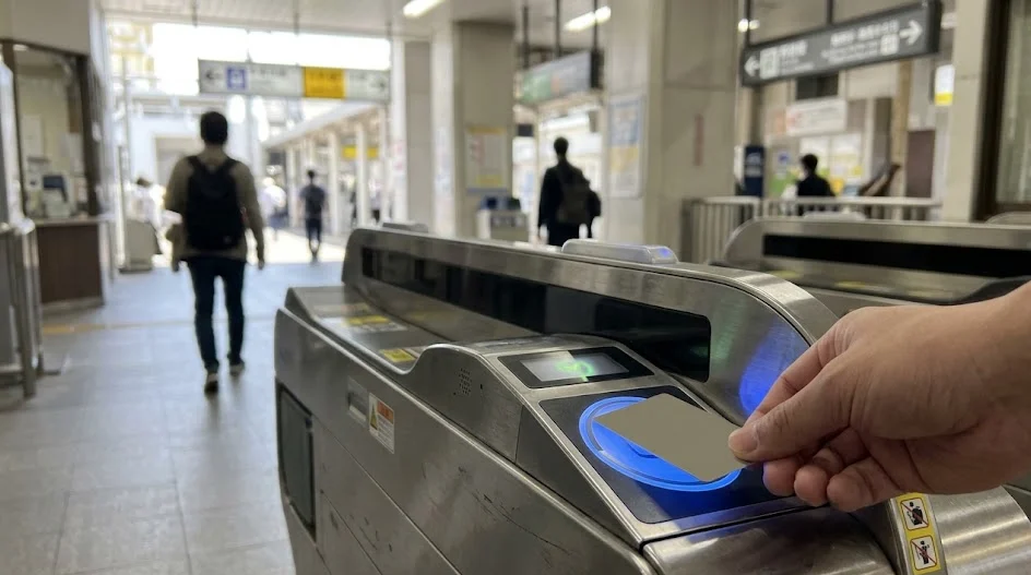
If you swipe your IC card at the wrong operator’s machine, you will get stuck. You then have to find a staff member to reset your card.
Generic routing tools rarely explain these nuanced operator transitions clearly. They assume you already understand the complex railway boundaries.
Door-to-Door Coverage vs Platform Precision
Comparing these tools directly reveals very different strengths. They are designed for completely different stages of your daily journey.
You will want a solid data connection from Airalo or Ubigi to use them effectively. Finding your route requires constant live updates.
Where Google Maps wins
Google Maps is the undisputed king of street-level navigation. It works exactly the same in Tokyo as it does in your hometown.
You type in your destination, and it guides you directly to the lobby. For walking directions above ground, nothing else comes close to its visual accuracy.

It is fantastic for planning your hotel location before you even book. We always use it when browsing Agoda or Booking.com for accommodations.
You can drop a pin on a potential hotel and instantly see the walking route to the nearest subway entrance. It makes visual planning incredibly intuitive.
Where NAVITIME takes over
But underground, your standard map loses its magic. GPS signals bounce around or drop out completely inside massive concrete transit hubs.
It often misses the specific train car positioning. This matters significantly when you have exactly three minutes to catch a tight connection.
If you board the wrong end of the train, the exit stairs might be miles away. You will likely miss your bullet train transfer entirely.
Never ignore the car number.
Japan Travel by NAVITIME focuses strictly on the transit data. It tells you precisely which platform to stand on and which car to board.
Handling Rail Passes and Express Surcharges
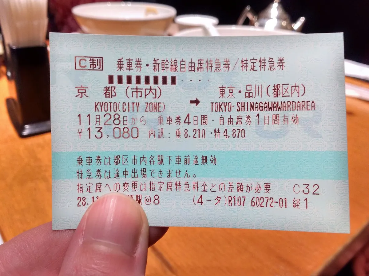
The biggest headache for international visitors is managing the Japan Rail Pass. The rules are notoriously strict regarding which trains you can use.
You cannot ride the fastest bullet trains without paying extra. Standard maps do not understand these complex ticketing rules.
Remember that whether the pass pays off depends on your route — add up the individual fares first.
The JR Pass blind spot
The Nozomi is the fastest bullet train on the Tokaido line. It is strictly excluded from the standard nationwide tourist pass.
Standard mapping tools will cheerfully route you onto a Nozomi train because it is the fastest option. They always prioritize speed by default.
If you jump on a Nozomi by mistake, the conductor will charge you the full base fare and seat fee. That can easily cost hundreds of dollars.
You have to manually check the train name against your pass rules. This causes immense stress for tired tourists dragging luggage.
Limited express ticket logic
NAVITIME removes this massive headache completely. You open the application settings and simply check a box for your specific rail pass.
It automatically hides any trains you are not officially allowed to ride. It only shows valid itineraries that keep you out of trouble.

This is not just for the national pass. It works beautifully for regional passes you might buy on Klook or GetYourGuide before your trip.
Local trains are easy, but limited express trains require a base fare plus a seat surcharge. The application breaks these costs down clearly.
Always double-check the train direction. The same platform often serves trains going opposite ways.
Which App Combo for Which Trip
Not every itinerary requires the exact same digital toolkit. Your specific travel route dictates your overall navigation strategy.
If you buy a regional Kansai Thru Pass on Klook, your app needs to know exactly which private railways that covers. It handles the complex math for you.
The Golden Route first-timer
The Golden Route connects Tokyo, Kyoto, and Osaka. This is exactly what most first-timers do over a standard fourteen-day vacation.
This route relies heavily on the Tokaido Shinkansen. You will be moving rapidly between massive, intimidating terminal stations.
- Tokyo Station
- Tokaido Shinkansen · 2 h 15 min · reserved seat
- Kyoto Station
- 10 min walk
- Your ryokan
You absolutely need NAVITIME here. The platform numbers at Kyoto Station are crucial for finding the correct exit quickly.
The Kansai regional explorer
Kansai explorers have it significantly rougher. Osaka, Kyoto, and Nara are served by a messy, competing web of private railway companies.
Kintetsu, Keihan, and Hankyu lines all actively compete with JR West. A specialized transit planner is essential to untangle this regional mess.
Osaka stations are pure labyrinths.
Even locals get lost transitioning from the Hankyu lines to the local subway. Clear, step-by-step directions are absolutely non-negotiable here.
The Tokyo-only traveler
If you are spending ten days just exploring Tokyo, the dynamics shift. You will mostly ride the Yamanote loop and color-coded subways.
The trains arrive every three minutes. You really do not need to stress about missing a critical intercity connection.
A standard visual map is usually sufficient for this style of trip. You just grab a digital IC card and casually tap your way around.
Side by Side: Maps and Navitime

Our comparison table breaks down the key technical differences. We focused on features that actually impact your daily travel experience.
Both tools offer robust free versions that handle basic needs. The premium features cost roughly ¥300–500 per month, as of 2026.
← Swipe to see the full table →
| Application | Free Version | Premium Version |
|---|---|---|
| Google Maps | ¥0 | ¥0 |
| Japan Travel by NAVITIME | ¥0 | ¥300–500 monthly |
Plan your trip: the tools we use
Our pick: Download both and use them together for different phases of the journey.
What most first-timers do
- Relying completely on visual maps for everything.
- Ignoring the specific platform numbers on signs.
- Boarding the wrong train car for quick exits.
What actually works
- Using a dedicated tool for exact track numbers.
- Checking which train car stops near elevators.
- Filtering route searches by rail pass validity.
The Honest Alternatives to Apps

Years ago, absolutely everyone used Hyperdia. It was the absolute gold standard for checking Shinkansen schedules across the country.
Sadly, it lost its detailed timetable data recently. It is no longer a practical routing option for tourists actively on the ground.
Jorudan Transit Planner
Jorudan Transit Planner is the next best technical alternative. It offers robust pass filtering and highly accurate platform data.
However, the user interface feels slightly less intuitive for English speakers. We generally prefer the visual layout of our top pick.
Apple Maps has quietly improved its Japan transit data. It now shows surprisingly accurate underground station layouts in major cities.
But it still lacks the crucial rail pass filtering system. It will not save you from accidentally boarding the wrong limited express train.
Asking station staff
Do not underestimate the power of physical maps. Every single train platform has a massive, highly detailed route board.
Station staff are incredibly patient with international visitors. You can always point to a destination on your phone and ask for the track.
Sometimes analog is just faster.

Setup Steps and Platform Survival Tips
Getting your phone completely ready before you leave your hotel is critical. Do not wait until you are staring blankly at a ticket machine.
If you book your hotel via Rakuten Travel or Agoda, pin the exact location immediately. Take five minutes over breakfast to plan the route.
Step 1: Download before you fly
Airport Wi-Fi can be spotty. Get your digital tools sorted while packing.
Step 2: Set your pass filters
Input your exact rail pass dates into the settings so it hides invalid trains.
Step 3: Load an IC card
Add a digital Suica to your phone wallet for seamless local subway taps.
Spotting the right train car
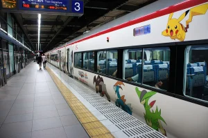
Pay close attention to the brightly colored circles on platform floors. They indicate exactly where the train doors will eventually open.

Line up patiently behind the yellow tactile paving blocks. Do not block the busy passengers aggressively trying to exit the train.
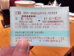
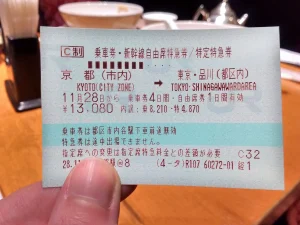
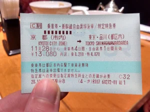
If you are riding a premium Green Car, look for the clover symbol on the platform monitors. The physical ticket only shows the car number.
Your transit planner tells you which staircase leads directly to that specific car. This saves you from running down the platform.
Dealing with underground signals
If you use a digital Suica in your phone, ensure your battery is charged. A dead phone means you absolutely cannot exit the ticket gates.
Always pack a reliable portable battery ordered from Amazon. Underground transit hunting drains standard smartphone batteries incredibly fast.
If you miss your scheduled train, just refresh the search. It will instantly calculate the next available departure.
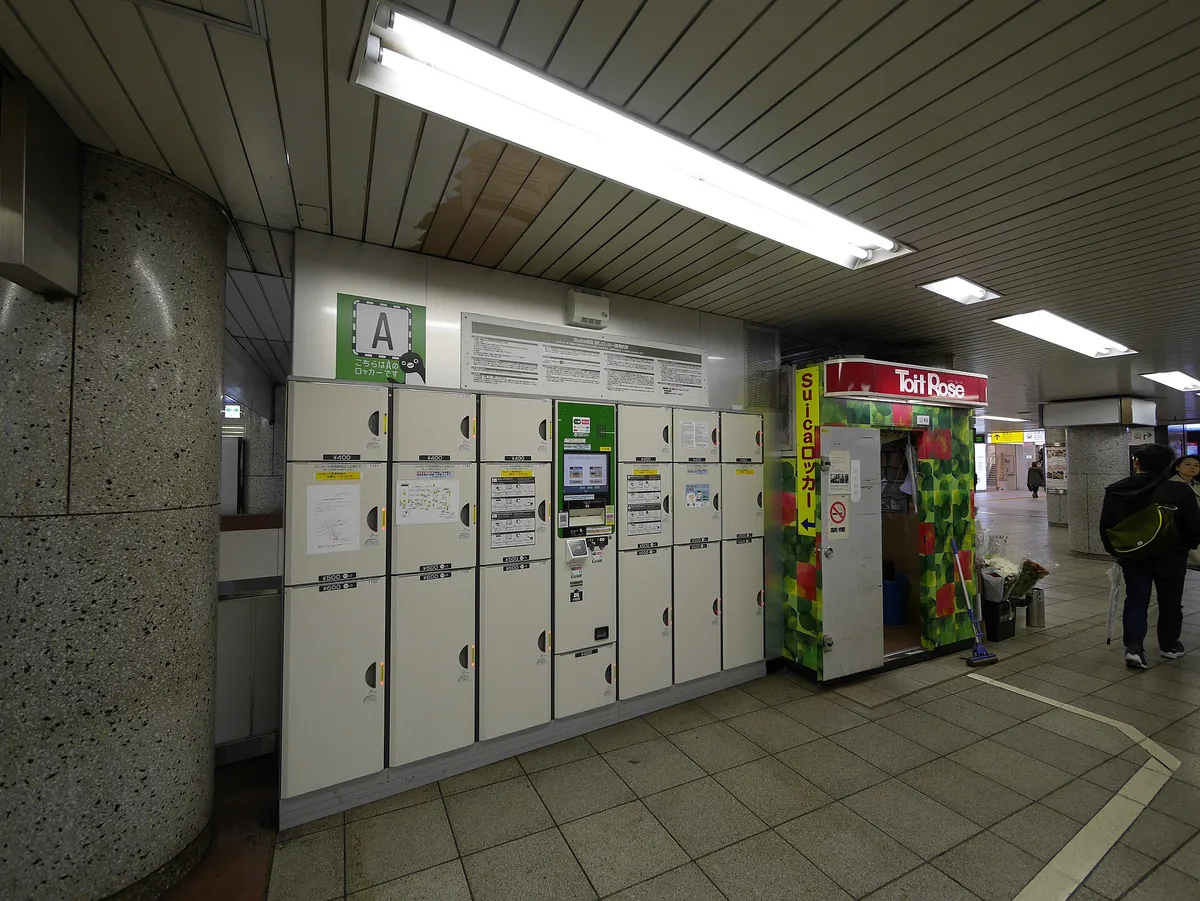
If you have massive suitcases, you definitely want to avoid stairs. Use Yamato luggage forwarding when possible to skip the train hassle entirely.
If you must carry them, filter your routes to prioritize elevators. This is an absolute lifesaver for young families traveling with strollers.
How We Checked These Routes
We do not just scrape random app store reviews. We ride these trains constantly while actively researching and writing our city guides.
Published documentation states these digital tools operate across Tokyo, Osaka, and rural stretches of the network. The premium subscription tiers cost roughly ¥300–500 per month in late 2026.
Official specifications indicate how quickly each tool reroutes when you miss a train. Developer notes also detail their offline reliability in deep subway stations.
The applications base their rail pass filters on current official JR rules. Always confirm schedules on the official Japan Rail Pass site.
Software interfaces change constantly.
While official sources do not list every single regional pass variation, the major ones are documented perfectly. Check the official developer sites for updates.
Final Verdict: Who Each App is For
Choosing between these digital tools is completely a false dilemma. You should definitely download and actively use both of them.
- Google Maps is for finding coffee shops, tracking walking routes, and locating your ryokan hidden down a narrow alleyway.
- Japan Travel by NAVITIME is your tactical transit tool. You open it only when you step inside a massive station.
It ensures you stand on the correct platform and board the right car. It actively prevents you from boarding trains your pass does not cover.
This simple combination eliminates most of your transit anxiety. You will navigate massive hubs with absolute confidence.
Download them both.

FAQ
QDoes Google Maps work offline in Japan?
You can download specific city areas for offline street walking. However, it will not calculate new train transit routes without an active data connection.
QIs the Navitime premium version worth it?
If you want to save complex routes offline or search by specific train names, yes. The free tier is usually sufficient for standard daily sightseeing trips.
QCan I use Apple Maps instead?
 ReaderYuki
QDo these apps show live train delays?
Yes, both major tools actively pull live delay data from the railway operators. They will display red warning banners if your specific line is stopped.
QHow do I find elevator routes?
NAVITIME has a specific toggle in the search options to prioritize step-free routes. This will guide you toward stations with accessible elevators.
QDo I need a physical IC card?
If you have a modern iPhone, you can just add a digital Suica or Pasmo to your Apple Wallet. Android users from overseas usually need a physical card.
Staring at a map of Shinjuku Station is enough to make anyone want to stay home.
Stop stressing over finding the perfect digital setup, load a Suica onto your phone, and figure out the rest when you get there.
Keep planning
- ① Install and test your eSIM before take-offAiralo and Ubigi eSIMs activate on arrival, but the install itself needs Wi-Fi. Do it at home and confirm the profile shows up in your phone settings.
- ② Save your first hotel’s address in JapaneseTaxi drivers and station staff read Japanese addresses far faster than romanised ones. Copy it from the booking confirmation into your notes app.
- ③ Set aside cash for day oneMany small restaurants, temples and rural buses are still cash-only. Airport ATMs at 7-Eleven and the post office accept most foreign cards.
Skip these and your first hour in Japan goes on finding Wi-Fi at the station instead of getting to your hotel.
🔍 How to sanity-check any price you read online
Blogs (including this one) go out of date. The official page always wins over a screenshot from two years ago.

Cover Photo: Marek Ślusarczyk (Tupungato) Photo portfolio, CC BY 3.0, via Wikimedia Commons